100-year Flood. A flood stage that, statistically has a 1% probability of occurring in any given year.
500-year Flood. A flood stage that, statistically has a 0.2% probability of occurring in any given year.
Abutment. The sloping sides of valley that supports the ends of a dam.
Backwater. The rise in water surface elevation caused by some obstruction such as a narrow bridge opening, buildings or fill material that limits the area through which the water shall flow.
Base Flood Elevation (BFE). The water surface elevation corresponding to a flood having a one percent probability of being equaled or exceeded in a given year.
Base Flow. Stream discharge derived from groundwater sources as differentiated from surface runoff.
Benchmark. A marked point of known elevation from which other elevations may be established.
Berm. A narrow shelf or flat area that breaks the contiguity of a slope.
Best Management Practices (BMP). Design, construction, and maintenance practices and criteria for stormwater facilities that minimize the impact of stormwater runoff rates and volumes, prevent erosion, and capture pollutants.
Capacity of a Storm Drainage Facility. The maximum flow that can be conveyed or stored by a storm drainage facility without causing damage to public or private property.
Catch Basin. A chamber usually built at the curb line of a street for the admission of surface water to a storm sewer of sub-drain, having at its base a sediment sump designed to retain grit and detritus below the point of overflow.
Chute or Rock Chute. A high velocity, open channel (lined with rip-rap) for conveying water down a steep slope without erosion.
Combined Sewer. A sewerage system that carries both sanitary sewage and stormwater runoff.
Contour. An imaginary line on the surface of the earth connecting points of the same elevation.
Contour Line. Line on a map which represents a contour or points of equal elevation.
Cornerstone. A stone or marker used by licensed land surveyors to survey land.
County Surveyor. A constitutional officer of the county, elected to a 4-year term from the county at large. Primary duties of the surveyor includes maintaining annexation descriptions, legal survey book, and section corner record book. The surveyor is also an ex-officio member of the County Drainage Board and the technical authority on the construction, reconstruction, and maintenance of all regulated drains or proposed regulated drains in the county. Other major responsibilities are voting board member in the County Plan Commission, and certification to the Indiana Alcoholic Beverage Commission.
Cross-Section. A graph or plot of ground elevation across a stream valley or a portion of it, usually along a line perpendicular to the stream or direction of flow.
Culvert. A closed conduit used for the conveyance of surface drainage water under a roadway, railroad, canal, or other impediment.
Cut-and-Fill. The process of earth grading by excavating part of a higher area and using the excavated material for fill to raise the surface of an adjacent lower area.
Design Standards. Detailed engineering drawings and/or specifications promulgated by public or private organizations that leave little choice to design engineers and technicians (e.g. manhole, catch-basin, and inlet standards).
Detention. Managing stormwater runoff by temporary holding and controlled release.
Dike. An embankment to confine or control water. Often built along the banks of a river to prevent overflow of lowlands: a levee.
Discharge. Usually the rate of water flow. A volume of fluid passing a point per unit time commonly expressed as cubic feet per second, cubic meters per second, gallons per minute, or millions of gallons per day.
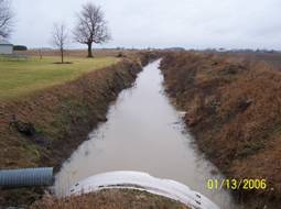
Ditch. A man-made, open drainage-way in or into which excess surface water or groundwater drained from land, stormwater runoff, or floodwaters flow either continuously or intermittentlyDrain. A buried slotted or perforated pipe or other conduit (subsurface drain) or a ditch (open drain) for carrying off surplus groundwater or surface water.
Drainage. The removal of excess surface water or groundwater from land by means of ditches, or subsurface drains. Drainage Area. The area draining into a stream at a given point. It may be of different sizes for surface runoff, subsurface flow and base flow, but generally the surface runoff area is considered as the drainage area.
Drainage Board. A board consisting of three to five persons including the county executive (commissioners) or members appointed by the executive body (at least one of the Board members must be a county executive). The County Surveyor serves on the Board as an ex-officio, non-voting member. The Board is responsible for adopting drain classifications and a long-range plan, and for making decisions regarding the design, construction, reconstruction, and/or maintenance of regulated drains in the county.
Drainage Improvement. An activity within or adjacent to a natural stream or a man-made drain primarily intended to improve the flow capacity, drainage, erosion and sedimentation control, or stability of the drainage-way.
Drainage Shed. See Watershed.
Drainage-way. A natural or artificial stream, closed conduit, or depression that carries surface water. This term is usually applied to all types of drains and watercourses, whether man-made or natural.
Dredging. A method for deepening streams, lakes, or reservoirs by scraping and removing solids from the bottom.
Erosion. The wearing away of the land surface by water, wind, ice, gravity, or other geological agents.
Excess Rainfall. The amount of rainfall that runs directly off an area.
Farm or Field Tile. A small diameter clay pipe installed in an agricultural area to allow drainage or farmland.
Filter Strip. Usually a long, relatively narrow area (usually 20-75 feet wide) of undisturbed or planted vegetation used to retard or collect sediment for the protection of watercourses, reservoirs, or adjacent properties.
Flap-gate. A device that allows liquids to flow in only one direction in a pipe. Backflow preventers are used on outlet pipes to prevent a reverse flow during flooding situations.
Floodplain. Land immediately adjoining a stream which is inundated when the discharge exceeds the conveyance of the normal channel. The channel proper and the areas adjoining the channel which have been or hereafter may be covered by the regulatory or 100-year flood. Any normally dry land area that is susceptible to being inundated by water from any natural source. The floodplain includes both the floodway and the floodway fringe districts.
Floodway. The channel of a river or stream and those portions of the flood plains adjoining the channel which are reasonably required to efficiently carry and discharge the peak flow of the regulatory flood of any river or stream.
Gabion. A wire mesh cage, usually rectangular, filled with rock and used to protect channel banks and other sloping areas form erosion.
Gradation. The distribution of the various sized particles that constitute a sediment, soil, or other material, such as rip-rap.
Grade. (1) The slope of a road, a channel, or natural ground. (2) The finished surface of a canal bed, roadbed, top of embankment, or bottom of excavation; any surface prepared to a design elevation for the support of construction, such as paving or the laying of a conduit. (3) to finish the surface of a canal bed, roadbed, top of embankment, or bottom of excavation, or other land area to a smooth, even condition.
Gradient. (1) A change of elevation, velocity, pressure, or other characteristics per unit length. (2) Slope.
Headwater. (1) The source of a stream. (2) The water upstream from a structure or point on a stream.
Hydrograph. A graph showing for a given point on a stream the discharge, stage (depth), velocity, or other property of water with respect to time.
Impervious. Not allowing infiltration.
Infiltration. Passage or movement of water into the soil.
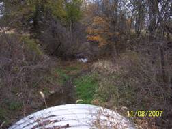
Intermittent Stream. A stream that ceases to flow in very dry periods.
Invert. The inside bottom of a culvert or other conduit.
Land Surveyor. A person licensed under the laws of the State of Indiana to practice land surveying.
Land Use Controls. Methods of regulating the uses to which a given land area may be put, including such things as zoning, subdivision regulation, and floodplain regulation.
Open Drain. A natural watercourse or constructed open channel that conveys drainage water.
Out-fall. The point, location, or structure where wastewater or drainage discharges from a pipe or open drain to a receiving body of water.
Outlet. The point of water disposal from a stream, river, lake, tidewater, or artificial drain.
Outlet Channel. A waterway constructed or altered primarily to carry water from man-made structures, such as smaller channels, tile lines, and diversions.
Private Drain. A drain that: (1) Is located on land owned by one person or by two or more persons jointly; and (2) Was not established under or made subject to any drainage statute.
Professional Engineer. A person licensed under the laws of the State of Indiana to practice professional engineering.
Receiving Stream. The body of water into which runoff or effluent is discharged.
Regulated Drain. A drain, either open channel or closed tile/sewer, subject to the provisions of the Indiana Drainage code, I.C.-36-9-27.
Reservoir. A natural or artificially created pond, lake or other space used for storage, regulation or control of water. May be permanent or temporary.
Retention. The storage of stormwater to prevent it from leaving the development site. May be permanent or temporary.
Retention Facility. A facility designed to completely retain a specified amount of stormwater runoff without release except by means of evaporation, infiltration or pumping.
Riprap. Broken rock, cobble, or boulders placed on earth surfaces, such as the face of a dam or the bank of a stream, for protection against the action of water (waves).
Riser. The inlet portions of a drop inlet spillway that extend vertically from the pipe conduit barrel to the water surface. Runoff. That portion of precipitation that flows from a drainage area on the land surface, in open channels, or stormwater conveyance systems.
Saturation. In soils, the point at which a soil or aquifer will no longer absorb any amount of water without losing an equal amount.
Sediment. Solid material (both mineral and organic) that is in suspension, is being transported, or has been moved from its site of origin by air, water, gravity, or ice and has come to rest on the earth’s surface.
Silt Fence. A fence constructed of wood or steel supports and either natural (e.g. burlap) or synthetic fabric stretched across area of non-concentrated flow during site development to trap and retain on-site sediment due to rainfall runoff.
Stormwater Runoff. The water derived from rains falling within a tributary basin, flowing over the surface of the ground or collected in channels or conduits.
Storm Sewer. A sewer that carries stormwater, surface drainage, street wash, and other wash waters but excludes sewage and industrial wastes. Also called storm drain.
Subsurface Drain (SSD). A pervious backfield trench, usually containing stone and perforated pipe, for intercepting groundwater or seepage.
Surface Runoff. Precipitation that flows onto the surfaces of roofs, streets, the ground, etc., and is not absorbed or retained by that surface but collects and runs off.
Swale. An elongated depression in the land surface that is at least seasonally wet, is usually heavily vegetated, and is normally without flowing water. Swales conduct stormwater into primary drainage channels and may provide some groundwater recharge.
Tile Drain. Pipe made of perforated plastic, burned clay, concrete, or similar material, laid to a designed grade and depth, to collect and carry excess water from the soil.
Tile Drainage. Land drainage by means of a series of tile lines laid at a specified depth, grade, and spacing.
Toe of Slope. The base or bottom of a slope at the point where the ground surface abruptly changes to a significantly flatter grade.
Top of Casting. The top elevation of a casting or lid on a manhole or inlet.
Topographic Map. Graphical portrayal of the topographic featured of a land area, showing both the horizontal distances between the features and their elevations above a given datum.